Sustainability
Nature tech: How data and innovation are reshaping ecosystem restoration
Aug 14, 2026
From drones and IoT sensors to AI and satellite imagery, technology is transforming how we restore, monitor, and sustain ecosystems, making nature restoration smarter, faster, and more measurable than ever before.
A new era for restoration
Technology is reshaping how we understand and restore natural systems. While traditional methods are still key, they were not built for the scale and speed of current environmental pressures: habitat loss, extreme climate events, or biodiversity decline.
With faster planning cycles and improved monitoring, nature-based solutions could provide a significant
37% of the emissions reductions
needed by 2030 to mitigate the impacts of climate change. Yet efficiency constraints make it harder to measure progress and adjust strategies when needed.However, we are entering what we could call a new era of restoration. One which blends long-term ecosystem science, Indigenous and community partnerships, data-driven innovation, and systems-based thinking.
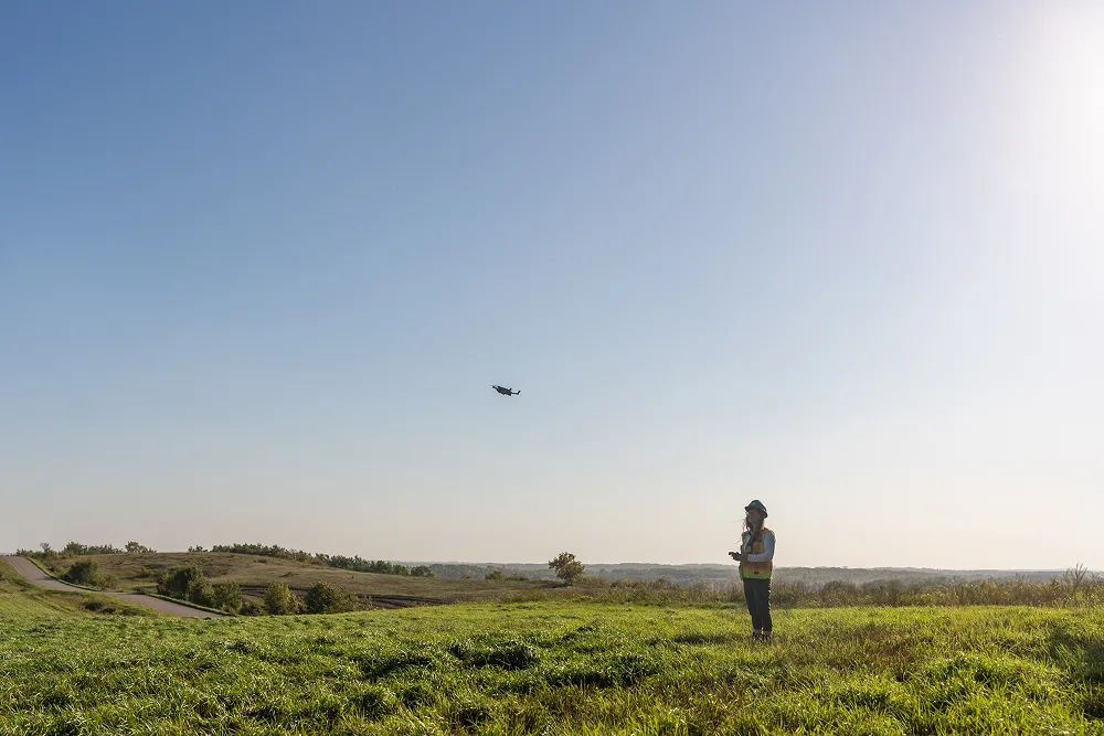
Drones, sensors, and satellite data can show how landscapes are evolving in near real-time, while AI helps interpret these signals to guide more precise decisions. Together, they support consistent, scalable monitoring that wasn’t previously possible.
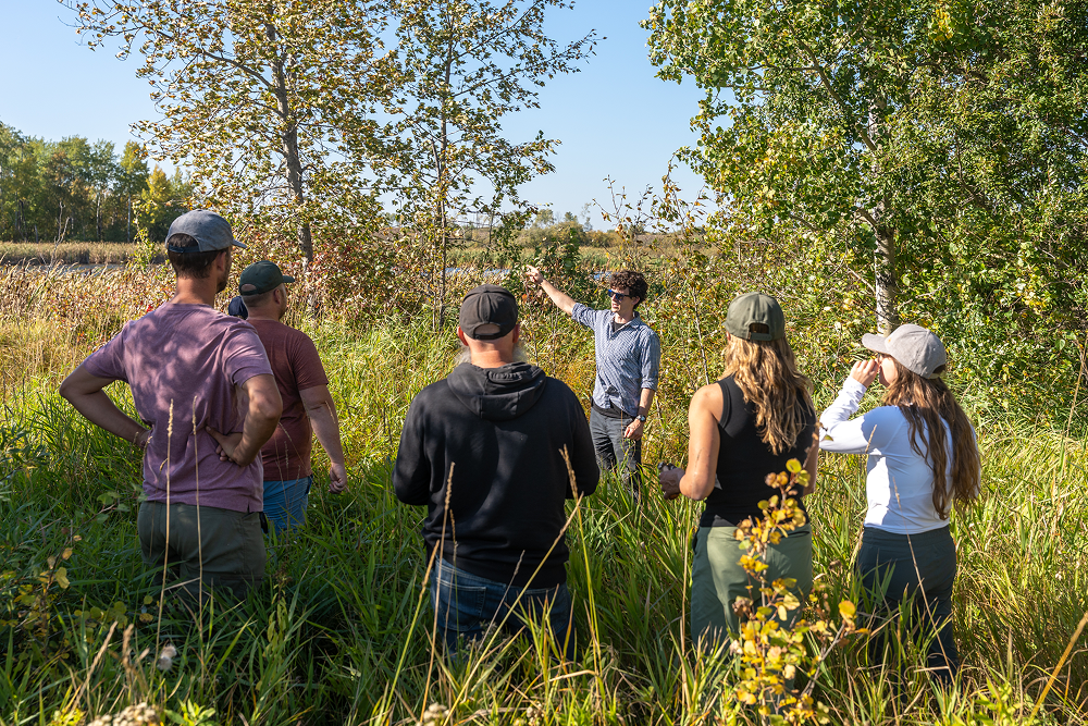
In TELUS projects, this means combining on-the-ground restoration with data that supports consistent monitoring. It’s what helps to move the work from single planting events to long-term restoration systems.
The case for nature tech
Due to today’s climate pressures, ecosystems are changing faster than many projects can track. To keep up, restoration needs tools that operate across large areas and respond to shifting conditions in near real-time. This is where technological advancements come in.
AI, sensors, and high-resolution imagery help detect environmental change earlier and with greater accuracy. These tools enable proactive decision-making, from identifying wildfire risk to tracking invasive species or drought stress. They also reduce the types of delays that can negatively impact a project, leading to greater success.
In restoration, this success refers to much more than carbon storage. Healthy ecosystems support biodiversity, stabilize soils, buffer floods, and strengthen community resilience. To realize these co-benefits, projects need reliable data and transparent verification. Consistent monitoring with nature tech helps teams understand how ecosystems are recovering and guides them in adjusting strategies as conditions change.
It also builds confidence among investors, regulators, and communities by verifying ecological outcomes. With a
$700B biodiversity funding gap
, clear data helps projects secure much-needed support towards ecosystem recovery and climate resilience.The technology transforming restoration
Restoration is becoming more dynamic, with new tools revealing capabilities and patterns that were once unknown. These technologies will not replace ecological expertise, but can expand what teams can see and anticipate. This can help accelerate the shift from reactive restoration work to proactive, adaptive, and informed.
AI and computer vision
AI and computer vision can provide more detailed and consistent monitoring of natural systems. For example, in TELUS’ work with the Vector Institute, models analyze vegetation patterns, identify canopy structure, and detect early ecological stress.
Computer vision, deep learning, and time-series analysis provide an understanding of ecosystem changes — far sooner than manual observation alone. This allows teams to capture seasonal variation and longer trends across multiple sites.
With team members able to track foliage change and anticipate stress-related decline, predictive restoration is possible. This means responding before drought, disease, or disturbance becomes visible, when there is still time to alter the outcome.
Drones and robotics
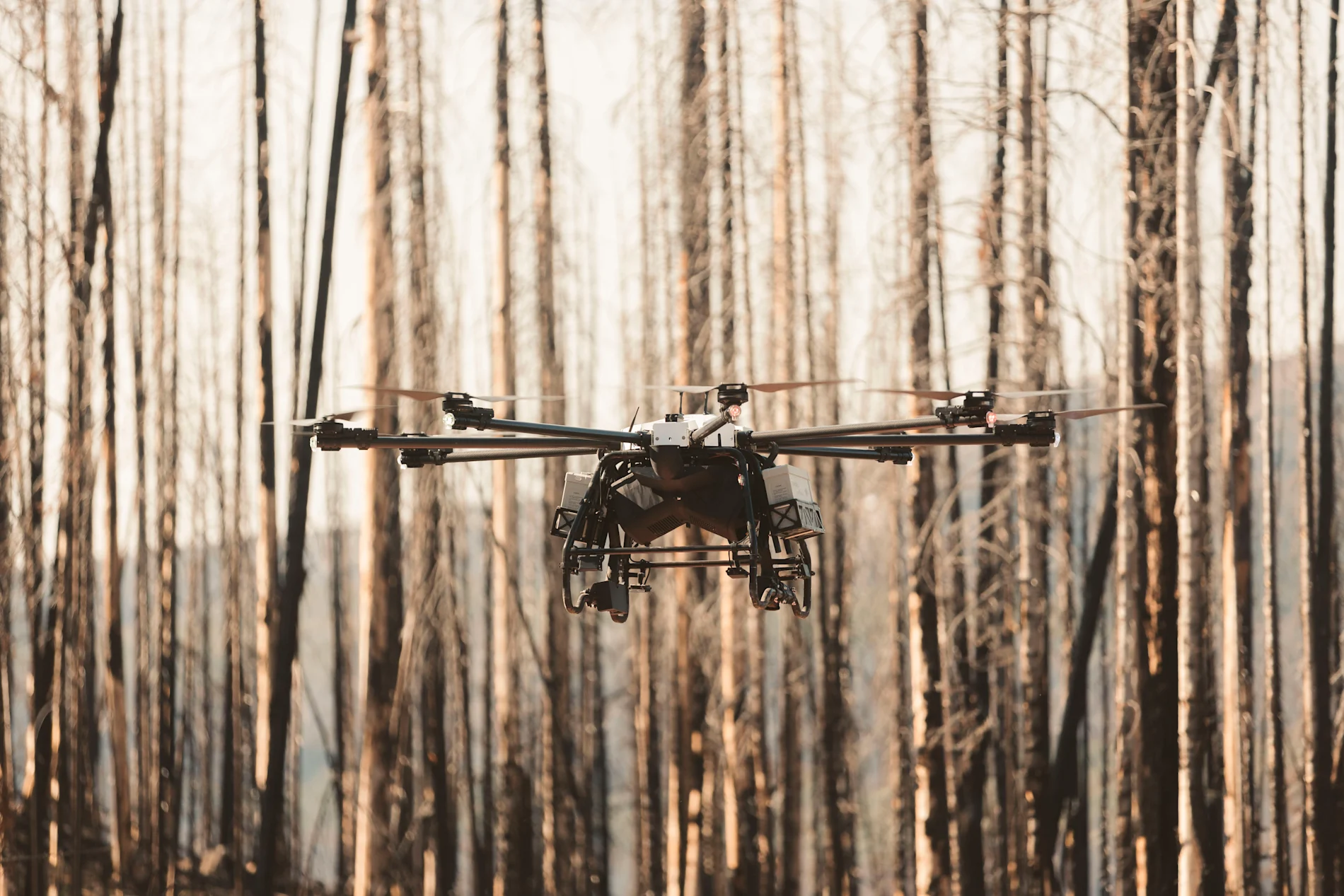
Wildfire sites can be difficult places for restoration teams. Slopes may be unstable, roads are often damaged, and heat-affected soils can make access unpredictable and even dangerous. Under these conditions, field crews are slowed, and the amount of ground they can cover early on is limited. But by using drones, teams can reach large or unsafe areas without having to wait for access.
In
TELUS projects with Flash Forest
, drones combine robotics, AI, and GIS to begin seeding earlier in the recovery window. Operating much faster than manual work, this system allows teams to begin planting sooner in areas that would be difficult to reach. The technology also improves the consistency of early-stage planting. Automated mapping and deployment help distribute seeds across varied terrain with steadier density and placement. Machine learning helps guide decisions about species mix and spacing, helping match each location’s ecological conditions.
IoT and sensor network
Shifts in heat and gas signal a wildfire long before flames appear, but these subtle signals can often slip past standard monitoring. To address this, tools that can watch forests continuously, without depending on line-of-sight or human presence, are required.
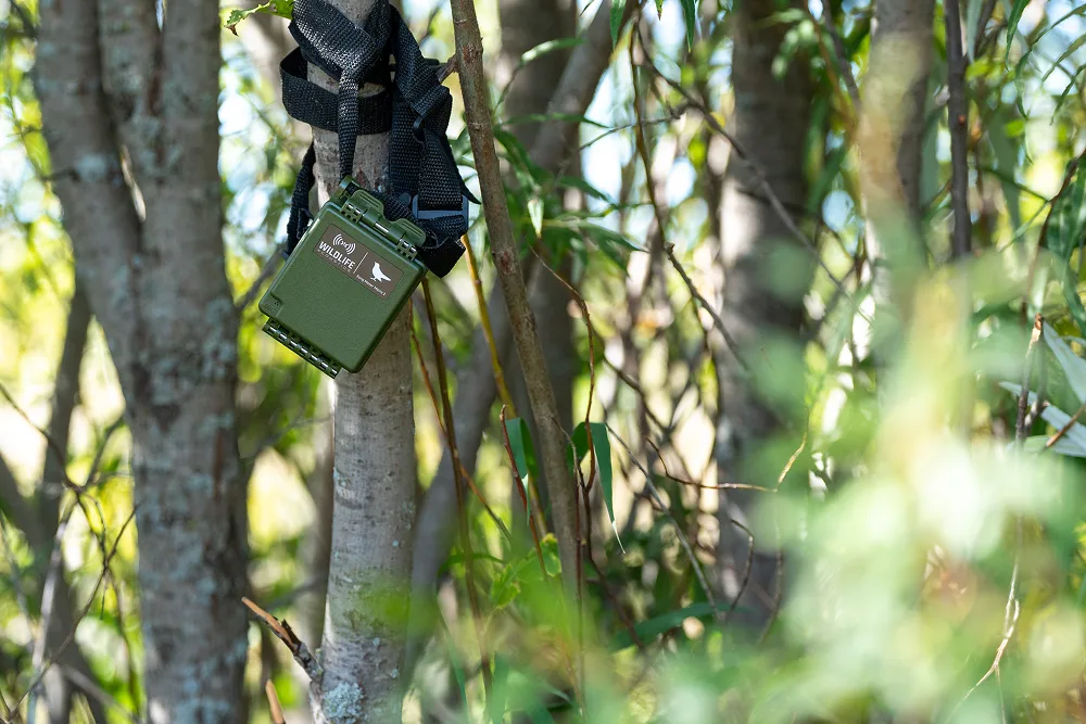
This is what Dryad Networks — an IoT system designed to detect fires within minutes using solar-powered sensors and a forest-wide mesh network — is designed for.
These sensors monitor environmental conditions and identify smoldering-stage signals that can be hard to spot. Information travels across large forested areas, even where connectivity is limited, enabling faster and more informed response decisions.
TELUS and Dryad
are now expanding these capabilities beyond wildfire detection. New sensors will help monitor soil moisture and tree growth, while sound and motion detection will support efforts to identify illegal logging and poaching. Together, these advances form the early foundation of what Dryad calls an “
Internet of Trees
” — a connected network that supports broader forest management and conservation.Satellite imagery and predictive modeling
Satellite imagery offers restoration teams a broader view of how ecosystems change over time. Paired with AI, these datasets help identify early signs of stress, map vegetation patterns, and understand landscape-scale risks such as invasive species or drought. This enables decision-making informed by ground conditions and wider environmental trends.
Layering climate, soil, and hydrology data allows predictive models to simulate restoration scenarios and assess how ecosystems may respond to future conditions. Teams can then prioritise areas for intervention and understand where restoration may have the strongest outcomes.
Project Guacamaya
— a collaboration with Microsoft’s AI for Good Lab — uses satellite imagery with solar-powered microphones, camera traps, and bioacoustics to monitor real-time soundscapes. The project helps track biodiversity in tropical forests and supports conservation teams working across the Amazon. Combining multiple data sources in this way creates a richer picture of ecosystem change and helps guide restoration decisions at landscape scale.Building restoration systems that last
Long-term restoration relies on clear data, strong relationships, and approaches shaped by local knowledge. Technology can help with speed and accuracy, but lasting work depends on trust and the relationships built around it.
1. Trust through clear information
Organisations increasingly want proof that their support is making a difference, especially amid rising scrutiny of sustainability commitments. Clear information means data that is consistent, repeatable, and linked to on-the-ground conditions.
In restoration, this includes measures such as survival rates, species mix, site conditions, and evidence of ecological change over time. When this information is collected openly, partners can see how projects are progressing in a concrete, reliable way. Sharing this information has the added benefit of helping teams understand how sites are changing and to adjust their work when needed.
2. Understanding through local partnership
Meaningful restoration starts with knowledge of local conditions and the history of a site, along with the relationships that connect people to place. This helps teams understand seasonal shifts, cultural priorities, and the conditions that support recovery over time.
Many TELUS projects are shaped in collaboration with Indigenous partners, whose long-standing relationships with the land guide decisions and strengthen restoration work. On Piikani Nation lands, for example, restoration along the Náápi Otsíthaatan (Oldman River) watershed includes community-led seed collection and cutting activities. These efforts support the land’s ecological needs while providing training and income.
3. Shared goals through climate resilience
Wildfire, flooding, and drought can reshape landscapes quicker than traditional monitoring tools can spot. Modern tools are changing this, with AI, sensors, and connected networks detecting these shifts in their initial stages, showing teams where to prioritise action.
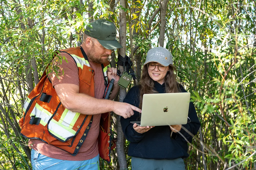
During emergencies, communication can be one of the first things to fail. Reliable connectivity is crucial for responders’ safety and team coordination under shifting conditions.
Responsible innovation for people and planet
As nature tech brings more capabilities to restoration work, it also brings new responsibilities. With more decisions guided by digital tools, the way they are designed and governed matters as much as what they can do.
AI reflects the data it is trained on, so projects must consider bias, access, and whose knowledge is included from the start. Responsible models draw from diverse datasets, local knowledge, and transparent methods that can be reviewed and replicated.
Data sovereignty also matters, as restoration can involve cultural or community information that requires careful handling. Responsible practice means communities keep control of
how their data is used and stored
, including through Sovereign AI environments designed for this purpose.Alongside the social considerations, restoration teams also need to think about their chosen technology’s environmental impact. As AI systems can use
significant amounts of energy
and water, choosing lower-footprint tools will be key to responsible use.Ultimately, responsible innovation makes sure that technology complements restoration, shaping decisions without overshadowing the knowledge, care, and ecological context behind them.
Idea for graphics - pop out box that sits alongside the above information containing this:
Sovereign AI Factories are part of TELUS’ effort to align AI development with environmental responsibility.
Powered by 99% renewable energy and cooled with systems that use 75% less water, these facilities show how AI infrastructure can be both secure and lower-impact.
They operate within sustainable data centres and keep sensitive workloads within Canada, offering a model for scaling AI while reducing resource use.
From restoration to resilience
Restoration and resilience are deeply connected. Ecosystems buffer communities from climate impacts, while reliable connectivity helps communities protect both land and people when conditions change.
When wildfires or floods disrupt operations, connectivity becomes safety infrastructure. TELUS maintains roaming arrangements that keep networks functioning if local systems fail, working with national and regional emergency teams to maintain communication.
Recently, TELUS deployed fibre, mobility service, power, and Wi-Fi to remote emergency sites, helping responders and local communities coordinate while also caring for displaced residents.
This same infrastructure fosters ecological resilience. Early-detection systems, such as IoT wildfire sensors, depend on continuous connectivity to relay smouldering-stage signals from remote forests. Reliable networks help teams act sooner, protecting ecosystems that would otherwise face greater loss and longer recovery.
Restoring forests today means protecting communities tomorrow — through wildfire buffers, carbon storage, and biodiversity corridors. Aligning restored ecosystems with early-warning tools and dependable communication helps communities prepare for disruption and supports recovery as landscapes change.
The next frontier of restoration
As AI, IoT sensors, and satellite imagery become part of routine monitoring, restoration becomes more measurable and more adaptive. When paired with local stewardship, these tools create systems that are grounded in place and can operate at scale. Reliable data and transparent methods make it easier for partners to assess progress, understand risks, and build long-term commitments. For organisations investing in climate resilience, this creates a clearer link between contribution and project success.
TELUS is investing in a future where technology and ecology develop together. Connected monitoring, responsible AI environments, and long-standing community partnerships are integral to this vision, supporting restoration while reinforcing the connectivity that makes long-term resilience possible. The next frontier of restoration is not defined by any single tool, but by the systems that bring them together. The opportunity now lies in collaboration — between communities, companies, and technology partners — to restore ecosystems at the pace this moment requires.
Together, we can support healthier landscapes and contribute to a more resilient, nature-positive economy for generations to come.
Sources
Canada. Public Safety. (2025, October 30). Government of Canada provides update on 2025 wildfires as support continues. Public Safety Canada.
https://www.canada.ca/en/public-safety-canada/news/2025/10/government-of-canada-provides-update-on-2025-wildfires-as-support-continues.html
Copernicus. (2024, September 5). OBSERVER: Revealing hidden land patterns with AI and Copernicus.
https://www.copernicus.eu/en/news/news/observer-revealing-hidden-land-patterns-ai-and-copernicus
First Nations Information Governance Centre. (n.d.). Our data, our stories.
https://fnigc.ca/#:~:text=Our%20data.,with%20its%20distinct%20world%20view
Fryling, J., & Microsoft Latin America Communications. (2024). Project Guacamaya uses daily satellite images, Amazon-specific AI models in battle against deforestation. Microsoft Source.
https://news.microsoft.com/source/latam/features/ai/project-guacamaya-rainforest-deforestation/?lang=en
Griscom, B. W., Adams, J., Ellis, P. W., Fargione, J., & co-authors. (2017). Natural climate solutions. Proceedings of the National Academy of Sciences, 114(44), 11645–11650.
https://doi.org/10.1073/pnas.1710465114
Sorenson, Q. M., Young, D. J. N., & Latimer, A. M. (2024). Tree planting outcomes after severe wildfire depend on climate, competition, and priority. Forest Ecology and Management.
https://www.sciencedirect.com/science/article/abs/pii/S0378112724006583
TELUS. (2023, April 18). Flash Forest secures Series A financing from TELUS Pollinator Fund for Good and OurCrowd, leading global reforestation efforts using drone technology.
https://www.telus.com/en/about/news-and-events/media-releases/flash-forest-secures-series-a-financing-from-telus-pollinator-fund-for-good-and-ourcrowd-leading-global-reforestation-efforts-using-drone-technology
TELUS. (2024, November 20). Reforestation on Náápi Otsíthaatan watershed: Supsūpii•po’omaaksin — In the spirit of planting seeds.
https://www.telus.com/en/blog/indigenous-connectivity/reforestation-on-naapi-otsithaatan-watershed
UN Environment Programme Finance Initiative. (2025, March 3). Governments adopt first global strategy to finance biodiversity: Implications for financial institutions.
https://www.unepfi.org/themes/ecosystems/governments-adopt-first-global-strategy-to-finance-biodiversity-implications-for-financial-institutions/
World Economic Forum. (2024, July 22). AI and energy: Will AI help reduce emissions or increase power demand? Here's what to know.
https://www.weforum.org/stories/2024/07/generative-ai-energy-emissions/